Capturing Seasons: How Drone Photography Can Enhance Tourism and Event Planning
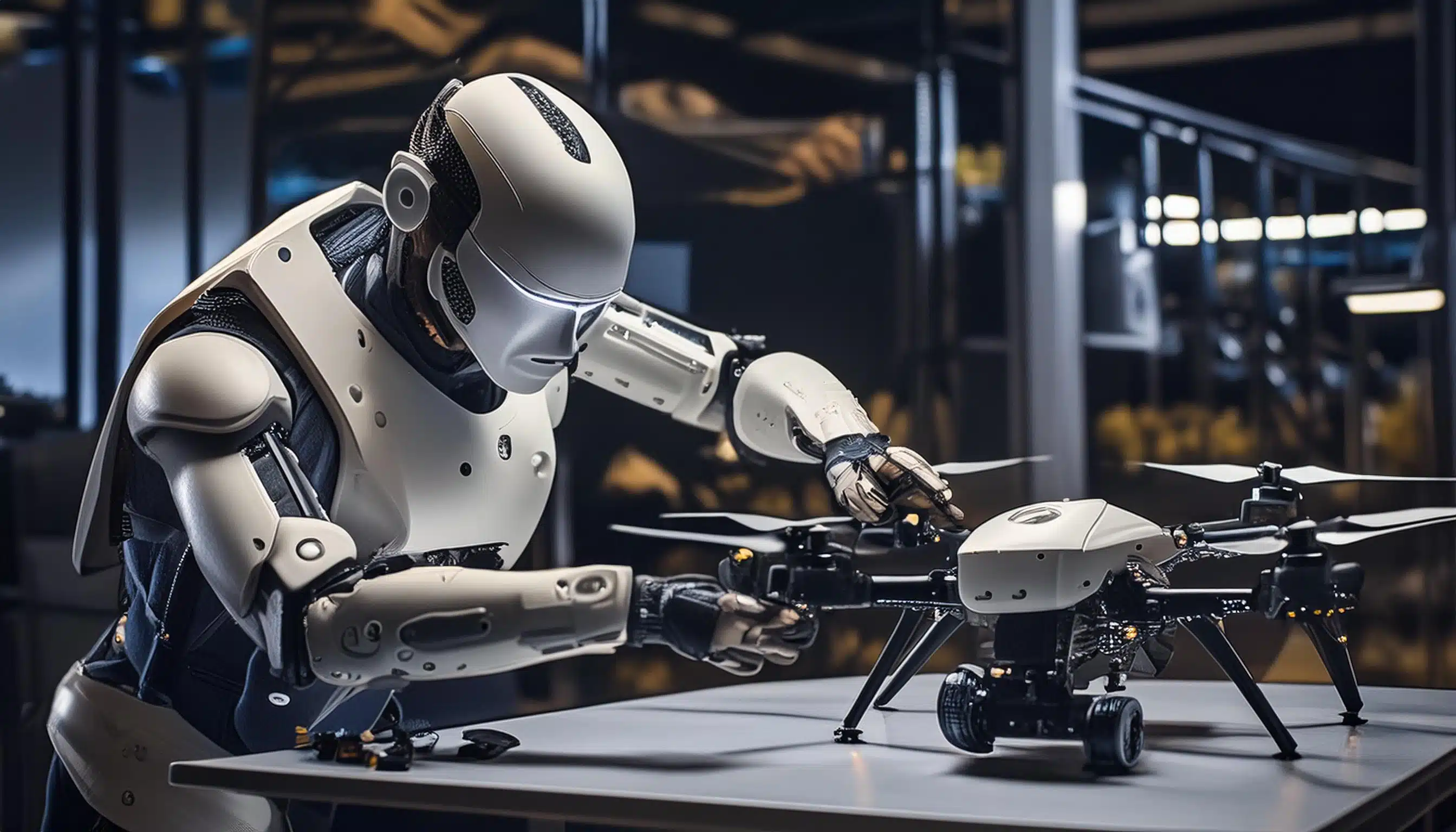
A robot building a drone

Capturing Seasons: How Drone Photography Can Enhance Tourism and Event Planning

Imagine standing on a mountain peak, gazing out at a breathtaking vista of colorful fall foliage stretching as far as the eye can see. Now imagine trying to capture that same experience with text alone. It wouldn’t quite do it, would it? In today’s visually driven world, that’s the challenge faced by many tourism boards and event planners. But what if there was a way to capture the essence of a destination or event in a single, unforgettable image?

This is where drone photography takes center stage. Studies show that content with relevant images receives a whopping 94% more views than content without images [Source: Sproutworth]. Drone photography unlocks a new level of visual storytelling, offering a unique aerial perspective that can dramatically elevate your marketing efforts in the tourism and event planning industries.

The Appeal of Seasonal Landscapes in Tourism

Visual content is a cornerstone of effective marketing in both tourism and event planning. Its importance stems from its ability to quickly convey emotions and experiences, which are central to attracting and engaging potential visitors and attendees. High-quality images and videos can capture the essence of a destination or an event, offering a glimpse into what can be expected. This visual allure not only enhances promotional material but also significantly boosts online engagement. Studies indicate that content with relevant images gets 94% more views than content without images. Furthermore, visual content on social media drives higher engagement rates, with images producing a 650% higher engagement rate than text-only posts.
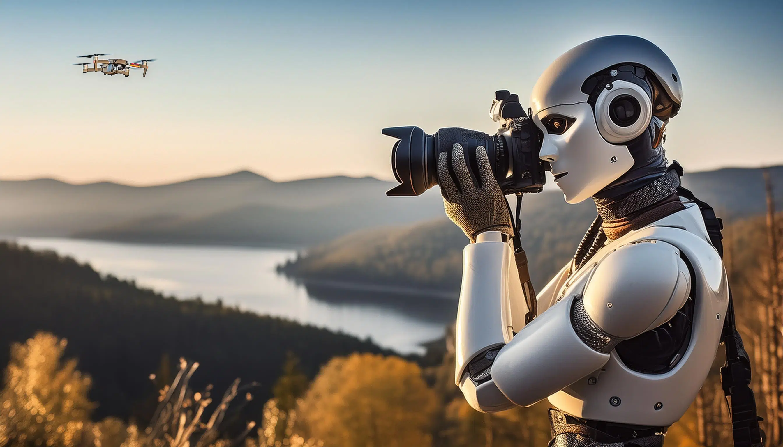
Drones and Photography: A robot taking photos accompanied by a drone
Golden Hour, Drones, & Photography

The Role of Visuals in Attracting Tourists

In the context of tourism, compelling visuals can evoke a sense of wanderlust, showcase the unique attributes of a destination, and differentiate it from competitors. For events, dynamic imagery can highlight key moments, emphasize the atmosphere, and encourage sharing on social media, effectively extending the event’s reach and impact. The strategic use of drone photography, in particular, adds a unique perspective that can dramatically elevate this visual storytelling, offering sweeping views that traditional photography might not capture. This makes drone imagery especially effective for marketing large-scale events or showcasing expansive natural landscapes, making it a valuable tool for marketers aiming to captivate and convert their target audience.

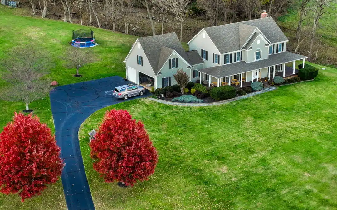
In today’s visually driven market, drones have emerged as a transformative tool for capturing the beauty of the natural world across different seasons. Their ability to soar above and provide new angles and perspectives makes them ideal for showcasing the distinct characteristics of each season in ways that ground-based photography cannot match. From the vibrant blossoms of spring and the lush greenery of summer to the rich hues of autumn and the pristine snows of winter, drones capture these transitions with stunning clarity and breadth.

This aerial vantage point not only enhances the visual appeal of a location but also provides a comprehensive view that can highlight the scope and scale of landscapes, making it an invaluable asset in tourism and event marketing. For instance, a drone can effortlessly capture the sweeping expanse of a fall foliage landscape or the bustling energy of a summer festival, providing potential visitors with a compelling preview that can inspire travel and attendance. As marketers look to differentiate their offerings and captivate an audience that is increasingly drawn to unique and immersive experiences, drones offer a way to create captivating content that resonates deeply with viewers, setting the stage for enhanced engagement and increased interest.

The Appeal of Seasonal Landscapes in Tourism

Visual content significantly influences tourist decisions, acting as a key determinant in the planning and booking phases of travel. Research shows that a majority of travelers, particularly Gen Z, are inspired to visit new locations based on user-generated content they encounter on social platforms. In fact, 86% of people report that seeing authentic, user-generated visuals can spark interest in a destination. This highlights a trend where potential tourists are increasingly relying on visual cues from everyday users rather than branded advertising or celebrity endorsements​ (Nosto)​.

Moreover, visuals not only attract attention but also enhance memory retention. People are likely to remember 65% of information three days after seeing it if it’s presented with an image, compared to only 10% when the information is conveyed through text alone. This “picture-superiority effect” emphasizes the lasting impact of images on memory and decision-making, making visuals a powerful tool in the tourism industry​ (Enterprise)​.

The preference for visual over written content is overwhelming, with 91% of consumers favoring visuals. This preference extends to the effectiveness of marketing strategies, where incorporating images can lead to more engaging and memorable marketing content​ (Tech.co)​. These statistics underscore the crucial role of visual content in influencing tourist decisions and the strategic advantage it provides in marketing destinations effectively.

The Role of Visuals in Attracting Tourists

West Virginia has utilized visually impactful campaigns to promote its natural attractions and outdoor activities effectively. For instance, the state has highlighted the New River Gorge, America’s newest national park, renowned for its river-rafting and stunning landscapes. This campaign focused on the park’s diverse offerings, from whitewater rafting to hiking, leveraging the natural beauty of West Virginia to attract outdoor enthusiasts​ (Almost Heaven – West Virginia)​.

Another successful initiative is the “Ascend West Virginia” program, which aims to draw remote workers to the state by emphasizing the lifestyle benefits of West Virginia’s outdoor recreational activities. This campaign combines incentives with visuals of the state’s scenic landscapes to attract a specific demographic interested in a balance of work and nature-centric living​ (Almost Heaven – West Virginia)​.

These campaigns showcase how effectively West Virginia uses its natural assets, combining striking visuals with targeted marketing strategies to boost tourism and attract new residents. These examples highlight the importance of using compelling imagery to promote tourism and lifestyle opportunities in a region.

A robot sitting at a computer editing a photo
Editing at the Speed of AI
Futuristic robot standing outside a modern luxury house with a 'For Sale' sign

Seasonal Changes and Their Appeal

Each season not only transforms landscapes but also brings its own array of events that draw visitors from near and far. Here’s a look at the visual differences and attractions of each season, highlighting specific events that capitalize on the seasonal changes:

Spring

  • Visuals: The rebirth of nature makes spring a photographer’s paradise, with blooming flowers like daffodils and cherry blossoms against a backdrop of bright green new leaves.
  • Attractions: Spring festivals, such as the National Cherry Blossom Festival in Washington D.C., attract visitors eager to celebrate the end of winter and the beauty of blooming cherry trees. Local botanical gardens also see an uptick in visits, offering lush landscapes and floral displays that are ideal for photography and leisurely tours.

Summer

  • Visuals: Bright, sunny days and vibrant landscapes make summer ideal for capturing high-energy activities and clear blue waters.
  • Attractions: Summer draws crowds to music festivals, beach parties, and sporting events. For instance, beaches become prime destinations for sun-seekers, while events like California’s Surfing Championships harness the vibrant beach culture and competitive spirit, providing dynamic photo opportunities.

Autumn

  • Visuals: Autumn is a spectacle of fiery foliage, with trees dressed in shades of red, orange, and yellow. This season offers a dramatic and colorful canvas for photographers.
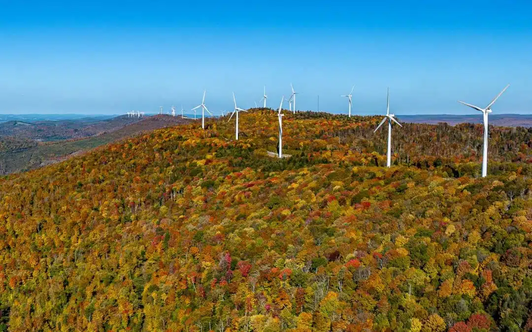
  • Attractions: The autumn season is synonymous with fall foliage tours, pumpkin festivals, and Thanksgiving parades. Events like the Vermont Fall Foliage Festival celebrate the season’s colors with arts, crafts, and local fare, attracting visitors who come to experience the quintessential American autumn.

Winter

  • Visuals: Winter blankets landscapes in serene whites and grays, offering stark contrasts and a quiet beauty punctuated by the occasional splash of holiday lights.
  • Attractions: Winter sports dominate this season’s tourist attractions, with destinations like Colorado’s ski resorts bustling with activity. The holiday season also brings festive markets and events like Germany’s famous Christmas markets, replicated in many U.S. cities, which glow with decorations and serve as a magnet for both photography enthusiasts and families.

These seasonal events not only highlight the natural beauty and cultural richness of each period but also provide unique and engaging experiences for visitors, making them excellent subjects for both amateur and professional photographers.

Futuristic view of a large city with robots walking the sidewalks
Is AI going to takeover?

Benefits of Drone Photography for Seasonal Tourism

Drone photography offers a distinct advantage over traditional photography, especially when capturing the vast and varied landscapes characteristic of different seasons. Here’s how drones elevate the visual storytelling of seasonal tourism:

Aerial Shots vs. Traditional Photography:

  • Broader Perspective: Traditional ground-based photography is limited by its single, fixed perspective, often bound by the photographer’s location and the surrounding environment. In contrast, drones provide a flexible aerial viewpoint that can capture expansive landscapes from above. This allows for stunning panoramas that showcase the full scope of a location, from sprawling autumn forests to entire beachfronts during summer.
  • Unobstructed Views: Drones can reach areas that are otherwise inaccessible to photographers, such as high mountain peaks covered in snow or the middle of a flowering field in spring. This capability ensures that the shots are free from the usual obstructions like buildings or trees that might compromise ground-level photographs.
  • Dynamic Content: Aerial photography can capture large-scale events, like festivals or outdoor concerts, in their entirety. For instance, a drone can film the layout of a winter sports event, showing the scale and the crowd in a single shot, or it can trace the winding path of a marathon through a city’s fall-colored streets, providing a dynamic perspective that adds depth to the visual content.

Capturing Expansive Landscapes and Events:

  • Seasonal Changes: Drones excel in illustrating the change of seasons. They can be used to create compelling time-lapse videos that show the transition from the lush greenery of summer to the rich, golden tones of fall, or from the colorful vibrancy of spring to the stark whiteness of winter. These visuals not only capture the beauty of the seasons but also encourage tourism by enticing viewers to experience these changes in person.
  • Event Coverage: For event planners and tourism marketers, drones offer a unique way to document and promote events. Aerial footage of a summer music festival, captured by drones, can highlight the size of the crowd and the energy of the venue, which is often difficult to convey through standard photos. Similarly, aerial shots of a ski resort teeming with winter activity provide a comprehensive overview of the facilities and the terrain, appealing directly to potential visitors.

By leveraging the unique capabilities of drone photography, tourism marketers can create more engaging, comprehensive, and visually stunning marketing materials that better capture the essence of the destinations and events they are promoting. This approach not only enhances promotional efforts but also offers viewers a more immersive experience of the attractions.

Cost-Effectiveness and Accessibility

Drone photography presents a highly cost-effective alternative to traditional aerial methods like helicopters, making it an accessible option for capturing high-quality aerial footage for tourism marketing.

Cost Benefits:

  • Reduced Expenses: Traditional aerial photography typically involves renting helicopters, which can be prohibitively expensive due to fuel, pilot fees, and maintenance costs. In contrast, drones require a significantly lower initial investment and minimal operational costs. The affordability of drones allows even small tourism operators to produce aerial footage that was once only within the budget of large corporations.


  • Flexibility and Frequency: The lower cost of drone operations also means that flights can be conducted more frequently and spontaneously. This is particularly beneficial for capturing the dynamic changes of seasons or covering multiple events throughout the year without the need to schedule expensive helicopter flights weeks in advance.

Accessibility and Ease of Arrangement:

  • Ease of Deployment: Drones can be launched quickly and from virtually anywhere, eliminating the need for accessing airstrips or helipads. This flexibility allows tourism marketers to capture aerial footage of remote or difficult-to-access locations without the logistical challenges associated with traditional aerial methods.
  • Simplified Logistics: Organizing a drone photography session is generally less complex and time-consuming. It often involves minimal crew—sometimes just a single drone operator—reducing the need for extensive coordination and planning. This ease of use extends to the ability to capture last-minute opportunities, such as unexpected favorable weather conditions or impromptu events, enhancing the ability to market destinations with up-to-date visual content.

In conclusion, drone photography not only cuts down on costs and logistical barriers but also offers enhanced flexibility, making it an invaluable tool for tourism marketing. This cost-effectiveness paired with easy accessibility allows for more creative and frequent use of aerial imagery, which can significantly enrich marketing materials and attract more visitors to a destination.

Futuristic view of a large city with robots walking the sidewalks
Is AI going to takeover?

Case Studies

Drone photography offers a distinct advantage over traditional photography, especially when capturing the vast and varied landscapes characteristic of different seasons. Here’s how drones elevate the visual storytelling of seasonal tourism:

Tourism Boards Utilizing Drone Footage

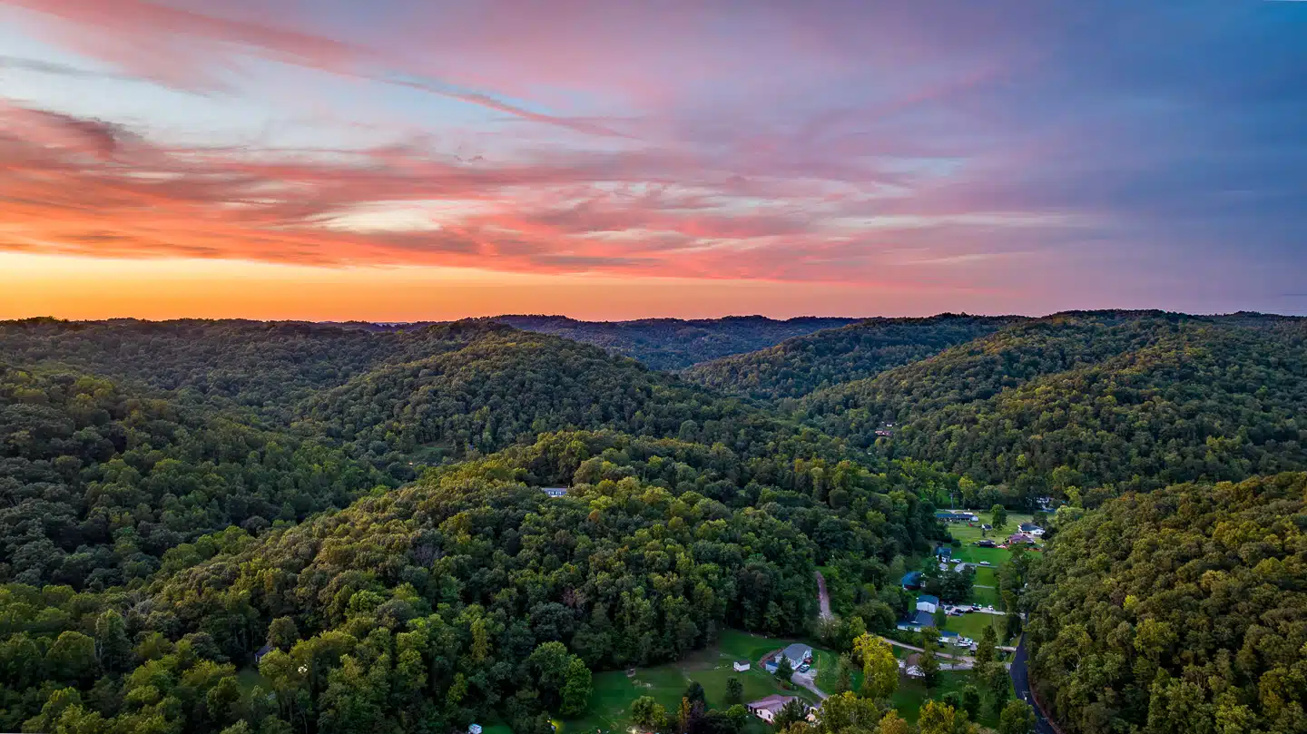
In West Virginia, tourism boards have effectively utilized drone footage to enhance the visual marketing of their scenic locales. For instance, the New River Gorge area, now recognized as America’s newest national park, has been prominently featured in promotional content. Drone videos showcase the breathtaking landscapes, including the expansive views of the river and the surrounding forests, which are particularly dramatic during the fall foliage season. These aerial views capture the vastness and the rugged beauty of the area, attracting outdoor enthusiasts and nature lovers to explore the hiking trails, rafting opportunities, and climbing spots available in the region. This approach has not only highlighted the natural beauty of West Virginia but has also played a crucial role in boosting tourism by providing potential visitors with a compelling visual invitation.

Events Enhanced by Drone Photography

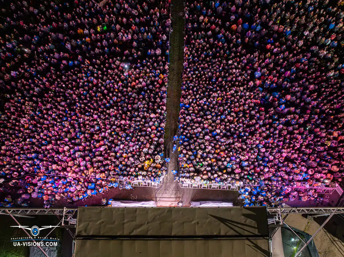
The 2023 Healing Appalachia event extensively utilized drone footage to enhance its coverage, capturing the spirit and scope of the festival effectively. The UA-Visions website showcases aerial shots that provide a unique and expansive view of the festival grounds, highlighting the large gatherings and the scenic landscape. This approach not only enriched the visual documentation of the event but also served as an engaging promotional tool, helping to convey the atmosphere and scale of the event to a broader audience. For more details and visuals, you can visit their dedicated page here.

Tips for Integrating Drone Photography in Marketing Strategies

Best Practices for Capturing Stunning Aerial Footage


To maximize the impact of drone photography in your marketing strategies, consider these detailed best practices for capturing exceptional aerial footage:


Optimal Timing for Shoots:

Capture footage during the golden hours—shortly after sunrise or before sunset—when the light is soft and golden. This timing not only enhances the aesthetic appeal with natural, warm tones but also reduces the harsh shadows and overexposure that can occur during midday.

Consider the position of the sun to optimize lighting angles and highlight the textures of the landscape.


Ideal Weather Conditions:

Avoid days with strong winds, which can destabilize the drone and degrade the quality of the footage. Light breezes are manageable but always monitor wind speeds before flight.

Overcast skies can provide diffuse, even lighting that minimizes shadows and glare, while partly cloudy conditions can create dynamic shadows that add depth to your footage.


Drone Camera Settings for Quality Footage:

Resolution: Always use the highest resolution available (4K or higher) to ensure that your footage remains crisp and high quality, even when viewed on large screens or used in high-quality prints.

Frame Rate: Use higher frame rates (60fps or higher) for smoother video playback, crucial for dynamic scenes or action shots. This setting is also beneficial for creating slow-motion effects in post-production without loss of detail.

Exposure and ISO: Manually control exposure to avoid washed-out skies or overly dark ground areas. Keep ISO as low as possible to reduce noise, especially in lower light conditions. Utilize neutral density filters to manage exposure on bright days.

Shutter Speed: Adhere to the 180-degree shutter rule (shutter speed is twice your frame rate) to maintain natural motion blur, balancing the amount of light captured and providing a cinematic feel to your video.

By adhering to these practices, you can significantly enhance the quality and effectiveness of your drone footage, making your marketing materials more engaging and visually appealing.

Regulatory Considerations and Safety 

When using drones for photography in public spaces, it’s crucial to understand and adhere to FAA regulations to ensure safety and compliance. Here’s a brief overview:

Registration: Drones weighing over 0.55 pounds must be registered with the FAA, and the registration number must be displayed on the aircraft.

Airspace Restrictions: Check local airspace restrictions using tools like the B4UFLY app to avoid flying in restricted zones such as near airports or government facilities.

Altitude and Distance Limits: Drones should be flown below 400 feet and within the visual line of sight of the operator.

Avoid Crowds: Avoid flying directly over groups of people, public events, or stadiums to minimize risks.

Privacy Considerations: Be mindful of privacy when flying drones; avoid capturing images or videos where individuals expect privacy.

Following these guidelines will help ensure that your drone operations are safe and legally compliant.


Conclusion

 Drone photography offers significant benefits for tourism and event planning by providing unique aerial perspectives that enhance promotional materials and attract more visitors. The ability to capture expansive landscapes and detailed aerial views of events adds a dynamic element to marketing efforts. For businesses and marketers in the tourism and event sectors, investing in drone technology can lead to more engaging, visually appealing content that stands out in competitive markets. Consider incorporating drone footage to elevate your marketing strategies and showcase destinations or events in compelling new ways.


Call to Action

 To fully leverage the potential of drone photography in your marketing strategies, consider scheduling a consultation with UA-Visions. Their expertise in both aerial and traditional photography can provide you with tailored advice to enhance your promotional efforts. Whether you’re looking to attract more visitors to a tourist destination or capture the dynamic essence of your events, UA-Visions can help you integrate advanced drone technology effectively. Reach out today to see how drone photography can elevate your marketing to new heights.

Enhancing Event Planning with Drone Photography
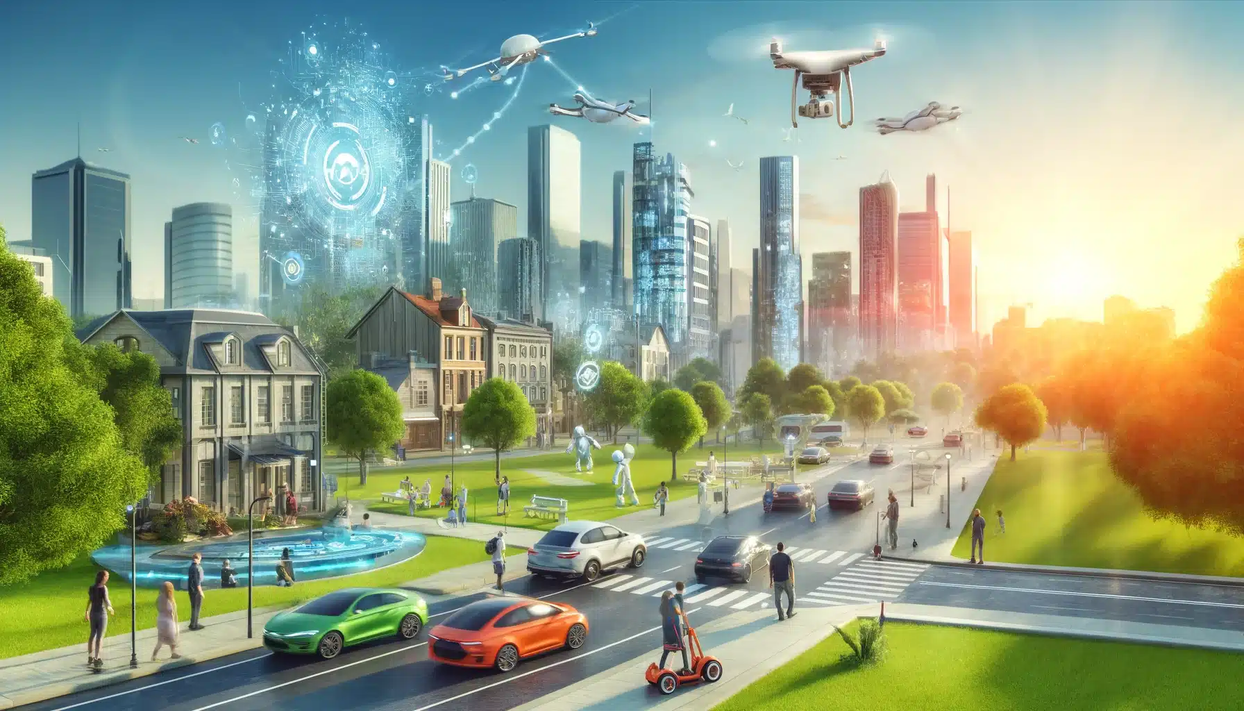
Visualize a cityscape in the future, powered by artificial intelligence. Include autonomous vehicles, smart buildings with interactive facades, drones

Planning and Promotional Uses

Drone photography is revolutionizing event planning and marketing, offering innovative ways to enhance both the logistical management and promotional strategies of events.

Planning and Logistical Uses:

  • Site Surveys: Drones are invaluable for conducting aerial site surveys, allowing event planners to assess the venue from above. This bird’s-eye view can help in understanding the layout, identifying potential issues, and planning the placement of stages, vendor booths, and other infrastructure. This comprehensive perspective ensures that every square foot of space is utilized efficiently, which is particularly useful for large outdoor events.
  • Crowd Monitoring: During the event, drones can be deployed to monitor crowd sizes and movements. This real-time data is crucial for managing crowd control, optimizing foot traffic flow, and enhancing security measures. By spotting congested areas, event organizers can quickly make adjustments to prevent bottlenecks and improve the overall attendee experience.

Promotional Uses:

  • Engaging Visual Content: Drone footage provides spectacular aerial views that can be used in promotional videos to capture the scale and energy of an event. Such dynamic footage can showcase vast crowds, highlight key attractions, and offer a preview of the event’s ambiance. This type of content is not only visually appealing but also serves to generate excitement and anticipation among potential attendees.
  • Social Media and Marketing Campaigns: Utilizing drone footage in social media posts and marketing campaigns can significantly increase engagement. The unique perspectives offered by drones create shareable content that stands out in crowded digital feeds. Promoting an event through striking aerial visuals can attract a wider audience, ultimately increasing attendance. Moreover, post-event videos featuring drone footage can be used to maintain interest in recurring events, helping to build a loyal attendee base by providing a glimpse of what they can expect in future editions.

Incorporating drone photography into event planning and marketing strategies not only enhances operational efficiency and safety but also significantly boosts promotional efforts, making events more appealing and accessible to a broad audience.

Drone technology has transformed live event coverage, offering unique capabilities that enhance both the broadcasting and post-event marketing of various gatherings, from sports competitions to concerts and festivals.

Live Event Broadcasting

Sports Events: Drones are frequently used in outdoor sports events like marathons, cycling races, and surfing competitions. For instance, during the Tour de France, drones capture aerial shots of the cyclists navigating challenging terrains, providing angles that traditional cameras cannot achieve.

Music Festivals: At large music festivals like Coachella, drones provide live feeds that showcase the scale of the event, offering aerial views of the crowd and performances, which are often streamed live to viewers worldwide.

Corporate Events: For corporate launches or large conferences, drones can broadcast live to screens within the venue, giving attendees a better view of the proceedings, especially in large spaces.

Benefits:

    • Enhanced Viewing Experience: Drones offer spectators unique perspectives and vantage points, such as overhead shots and bird’s-eye views of the entire event area, enhancing the overall viewing experience.
    • Dynamic Content Creation: The ability to move quickly and change angles seamlessly allows drones to capture more dynamic, engaging content than static cameras or even handheld videography.
Visualize a cityscape in the future, powered by artificial intelligence. Include autonomous vehicles, smart buildings with interactive facades, drones

Event Recap and Marketing


Benefits of Aerial Footage:

Compelling Highlights: Drone footage can be used to create compelling highlight reels for event recaps, showcasing the best moments with sweeping shots that convey the event’s atmosphere and excitement.

Marketing Material: Aerial videos serve as powerful marketing tools for future events. They can be used in promotional videos to demonstrate the venue’s capacity and the event’s energy, enticing future attendees.

Social Media Engagement: Clips and images from drone footage tend to perform well on social media, driving engagement through likes, shares, and comments, which boosts visibility and promotes the event organically.


Real-world Impact:

Increased Attendance: By providing a sneak peek into what attendees can expect, well-crafted drone footage used in marketing campaigns can directly increase interest and attendance for future events.

Sponsorship and Monetization: High-quality aerial footage can also attract sponsors by displaying the event’s reach and impact, providing a more attractive proposition for potential partners.

The integration of drone technology in live event coverage not only enriches the experience for both attendees and remote viewers but also plays a crucial role in the strategic marketing and successful execution of events. This dual benefit makes drones an indispensable tool in the modern event planner’s toolkit.

Comments

The Future of Aerial Imagery: How AI is Shaping Drone Operations and Photography

The Future of Aerial Imagery: How AI is Shaping Drone Operations and Photography

A robot building a drone

The Future of Aerial Imagery: How AI is Shaping Drone Operations and Photography

In the rapidly evolving world of technology, artificial intelligence (AI) is a game-changer, especially in the realms of drone operations and aerial imagery. This article delves into how AI is transforming these fields, enhancing capabilities, and opening up new opportunities for enthusiasts and professionals alike. Whether you’re a tech aficionado, a professional photographer, or someone curious about the future of drones, you’ll find exciting developments unpacked here.

The Rise of AI in Drones and Photography

Artificial intelligence is not just a buzzword; it’s a powerful tool that’s reshaping how cameras and drones operate. From improving image quality to enabling more autonomous operations, AI’s role is pivotal and growing. But what exactly does AI integration look like in these technologies?
Drones and Photography: A robot taking photos accompanied by a drone
Golden Hour, Drones, & Photography

AI-Driven Features in Modern Drones

Autonomous Flight

Harnessing the capabilities of artificial intelligence (AI), modern drones are now pioneering the future of autonomous aerial technology. These drones are not just flying machines; they are intelligent systems capable of executing intricate flight patterns, decision-making in real-time, and adapting to complex environments with little to no human intervention. Their ability to take off, navigate, land, and avoid obstacles autonomously is pivotal for executing tasks that would otherwise be risky or unattainable by human pilots.

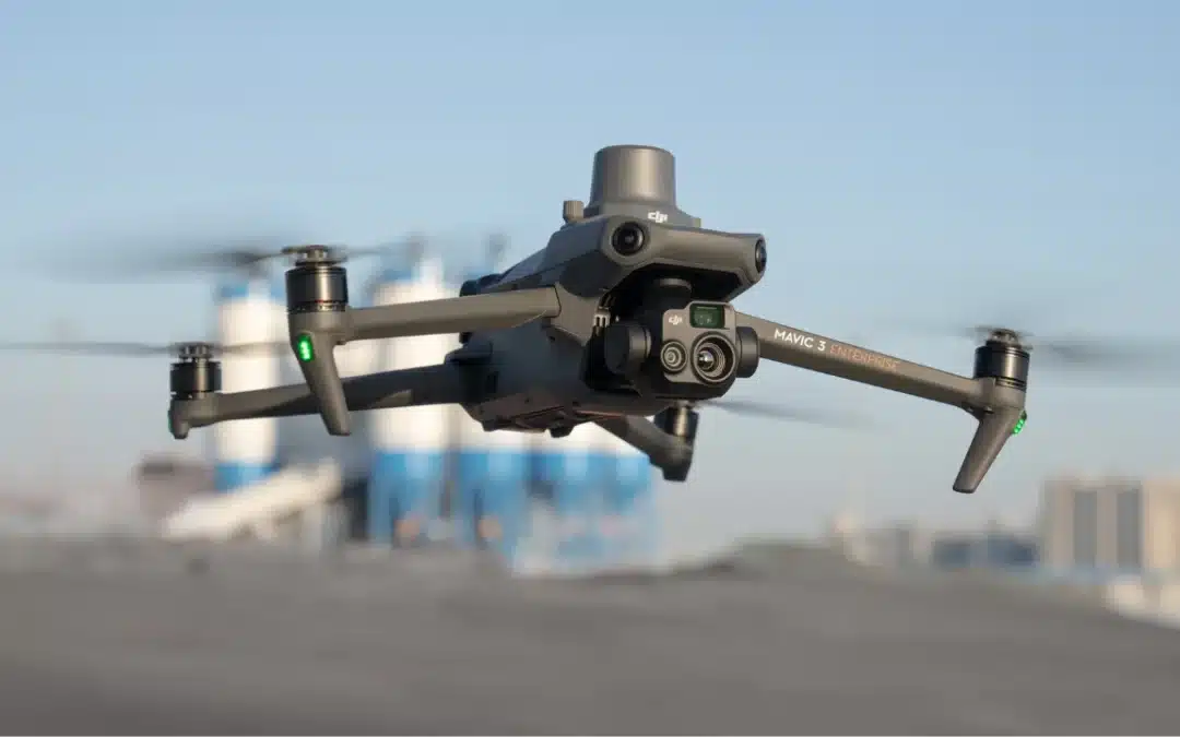
As drone technology continues to evolve with AI at the helm, we can expect to see even more sophisticated features. These could include advanced object recognition for finer obstacle detection and evasion, accelerated data processing for real-time mapping results, and seamless integration with various technological ecosystems. AI drone mapping using drones like the Skydio 2 or the DJI Mavic 3 Enterprise is not just a tool of modern technology; it’s a harbinger of the data-driven operational transformation taking place across industries worldwide.

Real-Time Data Processing

AI enables drones to analyze the data they collect while still in flight. For example, drones used in agriculture can immediately process images of crops to detect signs of disease or drought, providing farmers with instant insights.

Smart Photography

Drones today come with AI-enhanced cameras that can automatically detect and focus on subjects, adjust lighting settings, and even compose shots. These features are particularly useful in dynamic environments where conditions change rapidly.

The AI doesn’t stop there—it also intuitively adjusts camera settings in response to the lighting conditions. From the soft hues of dawn to the harsh midday sun, drones can automatically calibrate their exposure settings to capture the perfect shot every time. This adaptability is crucial in dynamic environments where light and shadows are constantly in flux, allowing for consistent quality without manual intervention.

Transformative AI Applications in Photography

Enhanced Image Processing

AI algorithms are incredibly adept at enhancing images. They can reduce noise, correct lighting, and even restore details that were not visible in the original shot. This leads to higher quality photographs with less manual effort.  At UA-Visions we count on Topaz Labs Photo AI.  Topaz Labs is a photo editing software company that utilizes AI for image enhancement..

Subject Tracking and Recognition

Cameras now use AI to track moving subjects and maintain focus on them, which is invaluable for sports and wildlife photography. AI can also recognize faces, which helps in portrait photography by adjusting settings for optimal results.

Creative Compositions

AI isn’t just about improving quality; it’s also creative. Perhaps one of the most groundbreaking features of AI-enhanced drone cameras is their ability to compose shots. Using complex algorithms, these cameras can suggest the best angles and compositions, turning every frame into a potential masterpiece. This is particularly beneficial in environments that are in a state of rapid change, such as live events or natural settings, where capturing the essence of the moment is key.

A robot sitting at a computer editing a photo
Editing at the Speed of AI
Futuristic robot standing outside a modern luxury house with a 'For Sale' sign

Industry Applications: Who Benefits the Most?

Film Making

Creative Applications: Filmmaking benefits greatly from AI’s ability to unlock new creative possibilities and streamline workflows.  In film making, AI-driven drones are revolutionizing how shots are taken. Check-out our YouTube Channel to see how were putting AI to the test. Drones can autonomously follow action, adjust to lighting conditions, and even participate in creative decision-making, allowing for innovative camera angles and movements that were previously impossible.

AI’s influence on filmmaking is profound. Drones equipped with artificial intelligence can independently track fast-paced action, ensuring that every pivotal moment is captured with high precision. This autonomy in following the subject allows filmmakers to craft scenes that are both dynamic and narratively compelling without losing focus on the main action.

Real Estate

Current Impact: Real Estate currently sees the most widespread adoption of AI photography applications with readily available tools for virtual tours and photo enhancement.  In real estate, drones provide not just basic aerial shots but detailed analyses of properties. AI-enhanced imaging can highlight features of a property more effectively, and 3D modeling helps potential buyers visualize spaces better than ever before.

Agriculture

Future Potential: Agriculture has the potential for the most significant long-term impact, with AI leading to increased food production and more sustainable farming practices.  Farmers are increasingly relying on AI-equipped drones for more than just basic imaging. These drones monitor crop health, track growth patterns, and even assess crop damage after natural disasters. The immediacy of AI processing allows for quicker responses to agricultural issues.

So…Who Benefits the Most?

Ultimately, all three industries stand to gain significantly from AI in aerial imagery. As the technology continues to develop, we can expect even more innovative applications that will reshape these industries in exciting ways.

As AI technology advances, its potential applications within these industries expand even further, promising to bring about revolutionary changes. The future might see AI in agriculture automating entire farming processes, in filmmaking creating entirely new genres of cinema, and in real estate transforming the way properties are marketed and managed.

It is a time of exciting possibilities, with AI in aerial imagery acting as a catalyst for innovation. Agriculture, filmmaking, and real estate are just the beginning, as the ripple effect of this technology is bound to create waves of transformation across numerous other industries. The full scope of AI’s impact is yet to be realized, but one thing is clear: as AI photography continues to evolve, it will redefine industry standards and propel businesses towards unprecedented levels of efficiency and creativity.

Futuristic view of a large city with robots walking the sidewalks
Is AI going to takeover?

The Future of AI in Drones and Photography

As we look ahead, the potential for AI in drones and aerial imagery only grows. Here are some emerging trends:

Improved Regulatory Compliance

AI-equipped drones can autonomously adjust their flight paths and operations to comply with local regulations, ensuring adherence to legal standards without constant human oversight. This capability is crucial for respecting no-fly zones, adjusting altitude limits, and maintaining privacy by automatically recognizing and blurring sensitive information like faces or license plates in real-time.

As regulations become increasingly intricate, AI’s ability to instantly adapt to legal changes is invaluable, facilitating safer and more compliant drone usage across various industries. This development not only enhances operational safety but also promotes broader, more secure adoption of drone technology.

Ethical AI Use

As artificial intelligence (AI) continues to advance, ethical considerations become increasingly important, particularly in the realms of privacy protection and data security. AI-driven devices, which often handle vast amounts of personal data, must ensure that this information is treated with the utmost respect for privacy and in compliance with global data protection laws. Implementing robust security measures and maintaining transparent data policies are essential for preserving public trust and ensuring ethical AI usage.

Furthermore, the growing autonomy of AI systems necessitates the creation of frameworks that ensure decisions made by these technologies are fair, unbiased, and accountable. This involves designing AI algorithms that avoid inherent biases which can lead to discrimination, as well as making AI-driven decisions transparent and understandable to users. Effectively addressing these challenges is vital for fostering a culture of responsibility and ensuring that AI’s integration into society is perceived as a positive and beneficial advancement.

Advanced Collision Avoidance

Future drones are set to become significantly safer and more reliable thanks to advancements in AI technology. With the development of more sophisticated AI algorithms, these drones will be capable of navigating through complex environments, dramatically reducing the risk of collisions. This enhancement is crucial for ensuring safer flights, especially in densely populated or cluttered areas where traditional navigation systems might struggle.

This leap in drone technology not only promises to minimize accidents but also paves the way for broader applications of drones in various sectors. By enabling drones to operate more safely in crowded spaces, these advanced collision avoidance systems will facilitate new uses in urban planning, delivery services, and emergency response scenarios, maximizing the potential of drone technology in everyday life.

Conclusion

Visualize a cityscape in the future, powered by artificial intelligence. Include autonomous vehicles, smart buildings with interactive facades, drones

The integration of AI into drones and photography is revolutionizing these fields, not only enhancing current capabilities but also setting the stage for future innovations that promise to transform entire industries. This advancement is impactful across various sectors, including technology, photography, and fields that benefit from imaging and autonomous flight. AI’s role in these areas is expanding the possibilities for how we capture, analyze, and interact with the world, leading to more sophisticated and efficient applications.

This technological evolution places AI at the forefront of a significant transformation, making it an exhilarating era for those involved in technology, photography, and drone operations. With each technological advancement, new opportunities arise for creative and practical applications, enhancing how we engage with and understand our environment. The ongoing development of AI promises a future where its influence permeates even more aspects of our daily lives and work, heralding a new age of innovation and discovery.

Dive Deeper


For those interested in exploring more about AI in drones and aerial imagery, stay tuned to the latest tech blogs, attend industry conferences, and participate in forums where these advancements are discussed. The future is here, and it’s powered by AI!

Comments

A Comprehensive Guide to Creating Accurate Maps with Drones

A Comprehensive Guide to Creating Accurate Maps with Drones

A Comprehensive Guide to Creating Accurate Maps with Drones

If you’re looking to create a map using a drone, it’s essential to follow a series of steps to ensure accuracy and capture the necessary data. In this Comprehensive Guide to Creating Accurate Maps with Drones, we will provide an overview of each step to Creating Accurate Maps with Drones, offering valuable insights and professional advice to optimize your mapping process.

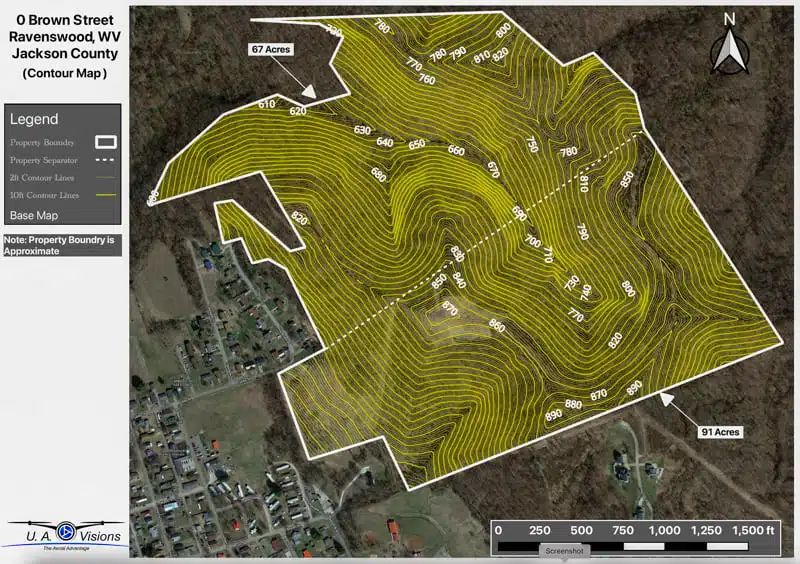
Contour map showing property elevations on Brown Street in Ravenswood, WV, highlighting 67 and 91-acre plots.
Step 1

Flight Planning: A Crucial Foundation for Success

Drone Mapping by US-Visions

Flight planning is a critical phase when it comes to mapping with a drone. To guarantee the capture of accurate data and the creation of precise maps, follow these key considerations:

1. Define the Mapping Area: Begin by identifying the boundaries of the area you wish to map and determining the desired scale of your map.

2. Choose the Right Drone: Select a drone suitable for your mapping area, taking into account factors such as size, required altitude, and camera specifications. Adhere to airspace regulations, obtain necessary permits, and be aware of any restricted zones.

3. Assess Terrain and Obstacles: Evaluate the terrain of the area and identify potential obstacles such as trees, buildings, power lines, or hills. Plan your drone’s flight path based on coverage area and desired image overlap, with a recommended overlap range of 60-80%. Utilize software like DroneDeploy or Pix4D to assist in flight path planning.

4. Camera Settings: Ensure your drone’s camera is properly configured for the mapping area. Set appropriate exposure, focus, and ISO settings.

5. Battery Considerations: Plan the drone’s battery usage, taking into account altitude, wind conditions, and flight speed, to ensure sufficient power for the entire flight.

Preparation for Creating Accurate Maps with Drones

Before taking flight, make sure to complete the following preparatory steps:

  1. Battery Management: Fully charge your drone’s batteries before the flight and have extra batteries on hand in case of longer flight durations.
  2. Firmware and Software Updates: Update your drone’s firmware and software to the latest version, optimizing performance and ensuring smooth operation.
  3. Compass Calibration: Accurate navigation is crucial. Follow the drone’s manual instructions to calibrate its compass before each flight.
  4. Accelerometer Calibration: Calibration of the drone’s accelerometer guarantees stable flight. Refer to the drone’s manual for specific calibration instructions.
  5. Camera Mounting and Configuration: Securely mount the camera on the drone and adjust its settings to match the requirements of your mapping area.
  6. Flight Settings Configuration: Configure your drone’s flight settings to capture the desired data. Adjust altitude, speed, and camera settings according to your flight plan.
  7. Pre-flight Check: Conduct a thorough pre-flight check to ensure all systems are functioning correctly. Verify battery levels, GPS signal strength, and camera settings.

Additionally, it’s essential to monitor weather conditions and obtain any necessary permissions or permits before commencing the flight.

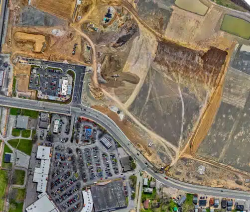
Aerial orthomosaic photo of a construction site with heavy machinery and an adjacent parking lot.
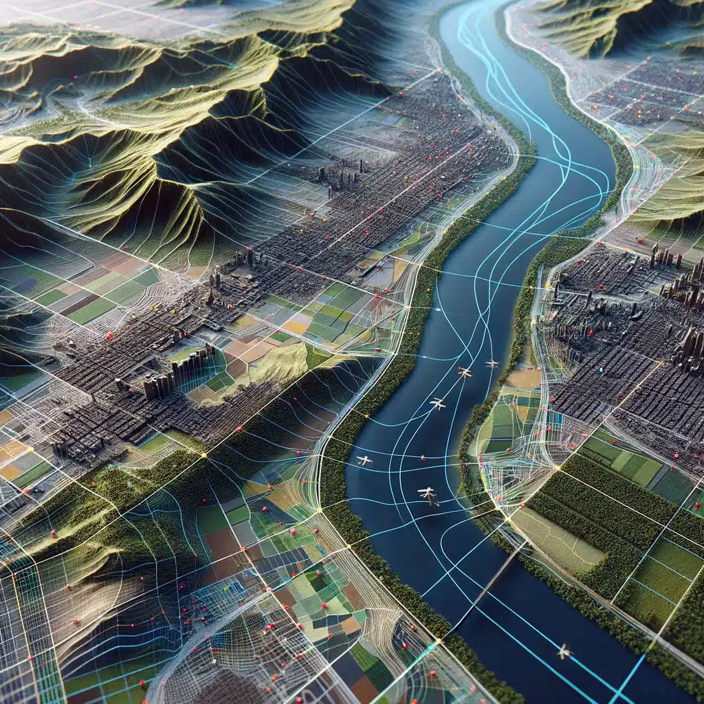
Accurate Maps with Drones: Detailed 3D map of a diverse landscape including a river, urban infrastructure, and forested areas, marked with a data grid from a drone photogrammetry survey.

Step 3 – Executing the Flight: Optimizing Data Collection

Efficiently fly your drone and collect high-quality aerial imagery by following these steps:

  1. Pre-flight Check: Before each flight, conduct a comprehensive pre-flight check to ensure all systems are functioning correctly. Verify battery levels, GPS signal strength, and camera settings.
  2. Launch and Stability: Launch your drone from a suitable location and ensure it achieves a stable flight.
  3. Follow the Planned Flight Path: Stick to the planned flight path to cover the designated area effectively. Continuously monitor the drone’s position and altitude throughout the flight.
  4. Image Capture: Utilize the mounted camera to capture aerial imagery of the area. Ensure camera settings such as exposure, focus, and ISO are optimized for the mapping area.
  5. Image Overlap: Confirm that captured images have sufficient overlap (60-80%) for accurate map generation using specialized software.
  6. Obstacle Avoidance: Safely maneuver the drone, avoiding obstacles like trees, buildings, power lines, or hills. Maintain a safe distance and closely monitor the drone’s position and altitude.
  7. Battery Monitoring: Keep a close eye on battery levels during the flight to ensure sufficient power to complete the mapping. Plan flight paths and battery usage accordingly.
  8. Landing: Conclude the flight by landing the drone safely. Ensure the landing area is obstacle-free, allowing for a gentle landing.

Step 4 – Data Processing: Transforming Imagery into Accurate Maps

Process the data captured by your drone with meticulous attention to detail using the following steps:

  1. Data Transfer and Organization: Transfer aerial imagery and accompanying data to your computer, ensuring proper organization and labeling.
  2. Mapping Software Utilization: Leverage industry-standard mapping software like DroneDeploy, Pix4D, or Agisoft Metashape to process the collected data. Create a new project within the software and import the drone-captured data. Ensure accurate camera settings and calibration information.
  3. Image Processing: Employ software algorithms to stitch together the drone-captured images and generate accurate 2D or 3D maps. Refine the map by using the software’s tools to remove errors, adjust boundaries, and enhance details.
  4. Exporting the Map: Export the finalized map in a suitable format such as GeoTIFF, KML, or DXF, based on the intended software compatibility. Customize resolution, scale, and projection to meet required specifications. Add informative labels, legends, and refine visual elements to ensure a professional and visually appealing map.
  5. Validation: Validate the map’s accuracy and reliability by comparing it with other data sources and conducting ground truthing. This verification process ensures the map’s precision and quality.
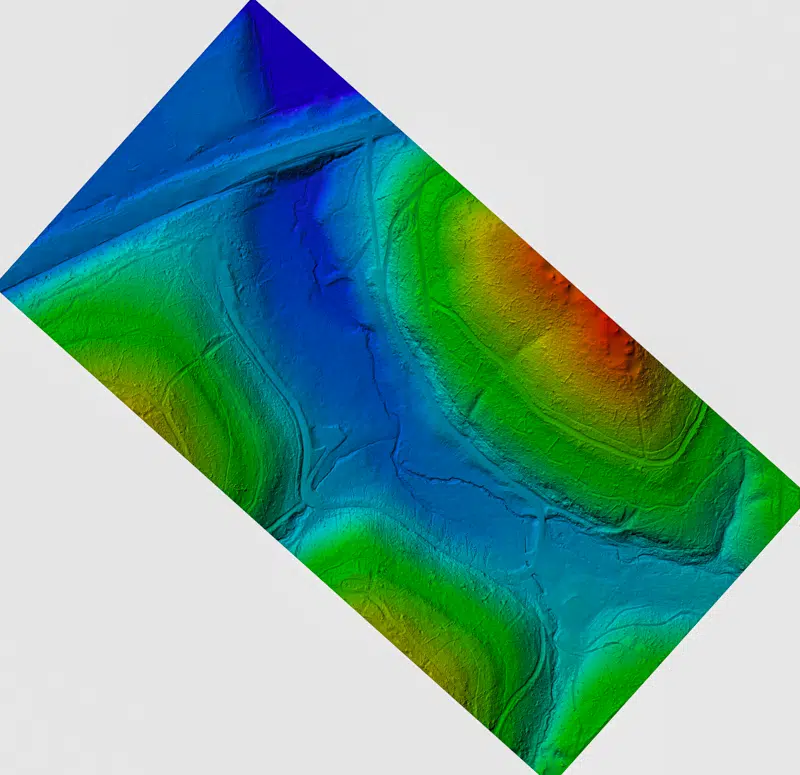
Digital terrain model of a landscape created using drone data and Agisoft Metashape Pro software.
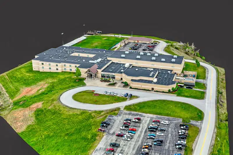
3D Model of a Middle School generated by UA-Visions

Step 5 – Finalizing and Saving Your Map

Conclude the mapping process by exporting the final map in the chosen format to an easily accessible location. Remember to utilize high-quality mapping software and ensure that the map meets all required project specifications. By adhering to these comprehensive steps, you can create accurate and visually stunning maps using drones.

In summary, by following a systematic approach that includes thorough flight planning, meticulous preparation, precise execution, and data processing with advanced mapping software, you can create accurate and visually captivating maps using drones. Remember to prioritize safety, adhere to regulations, and validate the map’s accuracy. With this comprehensive guide, you’ll be well-equipped to optimize your drone mapping process and achieve exceptional results.

We hope that some if not all of these tips will help you in some way in the future. Thanks for reading and showing your support.

For more information on our services, stop in and check us out at www.ua-visions.com.

By the UA-Visions Team

Comments

Experience Our Work WITH VIDEO Visit our Social Pages

Digital Media Services & Drone Imaging | Special Event Digital Media

All our captivating video footage from many of our projects can be found on our social media pages. Dive into a world of mesmerizing digital media services & drone imaging and relive the moments we’ve captured by clicking one of our pages below.

Get in touch

Let’s Get Connected

Have questions, comments, or concerns? We’re here to help! Please fill out our contact form, and let’s start the conversation to address all your needs.

    21 Tips on How to Create Better Drone Photos and Video

    21 Tips on How to Create Better Drone Photos and Video

    Creating Better Drone Photos and Video

    The increasing availability of drones over the past few years has opened the door for a variety of industries. Specifically for photographers and videographers, drones have made it possible to capture incredible images and footage from places previously only accessible by helicopter.

    Before you dive into firing up the brand new DJI Mavic 3 or Mavic Mini Pro, take a look at Drone Flying: 15 Tips on Safe Drone Operations.

    Although I have years of experience with drone photography and photography in general, I’ve learned that if you ask the top five photographers in the U.S. what they’re top photography tips would be, you would get five different answers. That’s the thing about photography, much of a photo’s beauty and wonder is in the eye of the beholder. If you noticed, I said ‘much of a photo’s beauty’ not all. There many other aspects that make up a great photo or video and in this article, I will be sharing many tips that will hopefully give you an edge up on how to Create Better Drone Photos and Video.

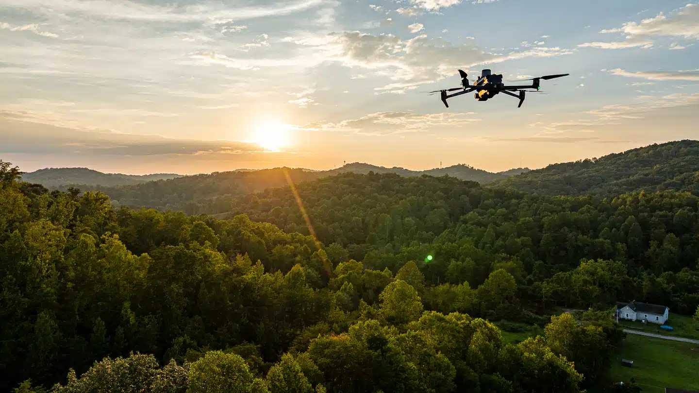
    Drone Photos: Aerial drone capturing sunset over the lush greenery of West Virginia's hills, showcasing UA-Visions' aerial photography services.

    Just the Tips

    Tip# 1 – Point Straight Down

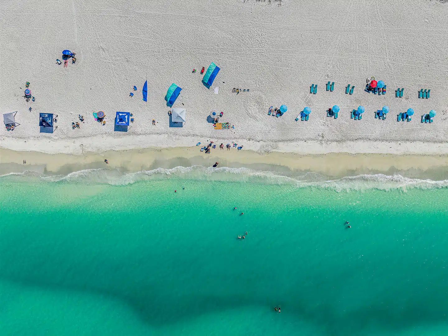
    If you’ve ever taken a flight, have you ever found yourself mesmerized looking out of the window to the ground below. This is a great shot that that provides an interesting view when you’re focused on the ground. It’s a perfect example of a shot that provides an interesting perspective that you can only capture with a drone.

    The colorful crowd of Healing Appalachia seen from above, a tapestry of festival spirits.

    Tip# 2 – Slow is Smooth and Smooth is Fast

    If you want to get good looking cinematic footage, then you’ll want to make sure that you have smooth stable footage and that means being gentle on your joysticks. If your drone is jerking and looking all over the place, this will quickly become a distraction and your viewers will immediately lose interest. One way to help with keeping your footage slow and steady is to use the tripod mode. Your drone may call it something else but typically there is a function that will slow down all the movement of your drone which in-turn will assist with creating that cinematic footage your after. If your really wanting to tweak your shots, head into the drone settings and you can slow these movements down even more.

    Tip# 3 – Be Quick to Create Better Drone Photos

    Just the opposite of those cinematic shots, fly as fast as it will go… legally of course. If you have ever watched footage from an fpv drone? I’m sure you’ve noticed how intense some of the shots came be. This is mainly due to the speed at which the drone is moving in relation to the objects around it. The faster you fly in close proximity to the ground or other object gives the viewer a much more dynamic experience. Since most drone owners don’t own fpv drones, to create similar shots, I suggest flying in a straight line as close to the ground or another object as your can using the sport mode. The reason I say straight line is because when you turn on sport mode, it disables all of the sensors.

    Tip# 4 – Have a Subject

    When you’re shooting your first video, big open landscapes are great but when you can put an object or a person in the frame. This gives you and the viewer much more perspective on the location. Having a subject will also give more visual interest to the photos and videos that you’re creating.

    Tip# 5 – Over & Under Exposure

    Over exposing is when everything is too bright you in the frame. Try to expose properly so that you have good contrast but you’re not too bright and not too dark. A good tool to use is your histogram which you can find on most drones. Using the histogram, make sure that all of your exposure values are somewhere in the middle. If you expose to bright and parts of your image are super white and blown out, you’re likely not going to be able to recover that. If you bring your footage into your editing software and you try to bring back those highlights, the image is just going to be white.

    Tip# 6 – Research Your Location

    If you think you have the ideal spot picked out, do this. Pull up Google Maps and see how the location looks from the sky. Look at photos or videos from other creators or other people that are online. It’s a good idea to know as much as possible beforehand so that you can find cool angles to shoot from and ideas on what to shoot when you get there. This way, your not draining all your batteries looking for the perfect composition.

    Tip# 7 – Sunrise & Sunset

    You’re going to get the best colors and the

    best life just as the sun’s coming up and just as the sun’s going down. This time of day you’re also going to get the best looking shadows. You can get big long stretched out shadows that are going to create even more visual interest depending on what it is that you’re filming. When you’re planning your shoots, try to do it closer to sunrise or sunset and that’s gonna instantly make your photos and video look that much better.

    Sunset Over an Emerald Forest | An aerial view captures a dense forest bathed in the warm glow of a sunset. The landscape showcases a rich tapestry of trees reaching towards the horizon, offering a tranquil and breathtaking vista.

    Sunrise & Sunset

    Tip# 8 – Know Your Why

    Have a reason to why you’re filming and what the purpose of you going out to shoot. If you’re going out to tell a story for something like a Vlog, know why. You want to make sure that you get the footage that you need and make sure that you’re not just spending a lot of extra time filming stuff that’s not going to be used. If you’re going out to photograph something specific, do your research like we were talking about earlier and know exactly what you need to be able to capture that shot. Just understanding why you’re going out what it is that you’re trying to capture will help with getting that specific shot for that specific project.

    Tip# 9 – Fly Lower & Show Scale

    Don’t fly as high as possible. Here in the U.S. there’s a 400 ft. flight restriction, however at 400 feet the primary shots you can get are big open landscapes. Don’t spend all your time up at 400 feet, get down close and you’ll be able to get a variety of shots and some cool different perspectives that you just can’t get with other cameras. Think about going from big open wide shots to right above the tree line and then possibly closer to the object or person. Using an object or subject as visual interest is great if you have a photograph of the epic landscapes and then you put a person in it. You really get a much better sense of the scale of everything that you’re taking a photo of. Using a drone to get these shots along with the use of a subject is a great way to demonstrate how big places really are.

    Tip# 10 – Shoot Footage Worth Capturing

    Pick interesting locations and go somewhere worth filming, not the same bland locations everyone has seen a thousand times before. If you’re going to take cool photos and videos, then go to places that have a unique look and can get you better looking shots. One thing that I’ve seen over and over, boring drone footage. Find something or somewhere unique and different. If you find a place, pay attention to how the landscape changes and how the shadows will play with the different objects that you’re photographing or taking videos of.

    Keep in mind, there’s all kinds of interesting stuff all around us. Just because you’re in a place that doesn’t have access to huge mountains or beaches doesn’t mean you don’t have interesting and unique things to photograph. Having a drone in the sky gives you a lot of opportunity to see things from a different perspective and there’s a lot of interesting things when you look at it from a camera that’s up that high.

     Tip# 11 – Look For Shadows

    Make it a point to get your drone up and point it straight down. While your there, look for how the shadows are playing with the landscape. You might see something completely unique that you’re not gonna see from the ground. As I mentioned earlier, the impact of these shadows is far greater when you’re right at sunrise when they’re stretched far out.

    Tip# 12 – Splitting your Frame

    When your shooting straight down or landscapes from above, you can do is split your photo or video in half using what’s in the frame. In another words, using a part of the landscape as your division line to split the frame and then you will have two contrasting elements that are side-by-side giving a visually pleasing effect.

    Vitamin Sea is good for the soul

    Split Frame

    Leading Lines Example

     Tip# 13 – Lead the Viewer’s Eyes

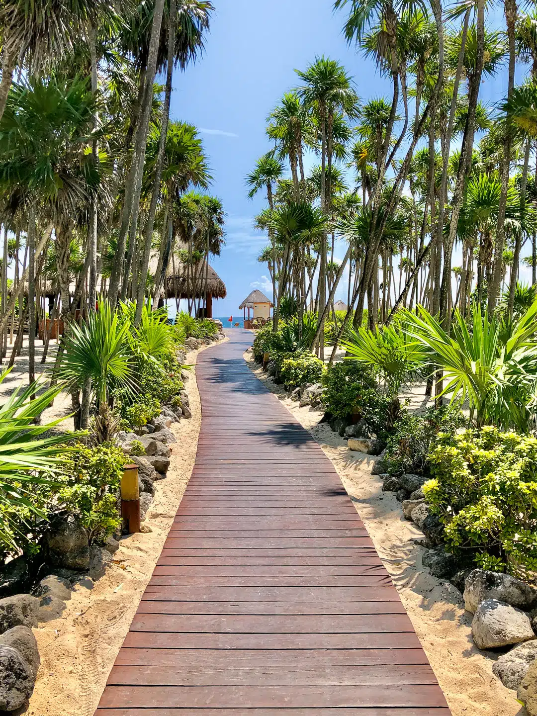
    Implement the concept of leading lines. This is using lines that are naturally found in the landscape that draws the viewer’s attention to a specific point in your photo or video. So find different lines, whether it is a physical line like a train track or just the way that the landscape is shaped and see if you can draw your viewers eye to one point in the photo or video.

    Tip# 14 – Always shoot in RAW

    If you are using a DJI drone, you’ll see in the camera settings two choices. I suggest you always shoot in RAW or .DNG if you plan on doing any color grading or editing in general. RAW images contain much more information and accommodate the editing process much better than a compressed JPEG image. If you need quick delivery and you’re not going to be doing anything to your photos, JPEG is perfect. One downside of shooting RAW is that this file type is massive in comparison and can quickly fill a hard drive.

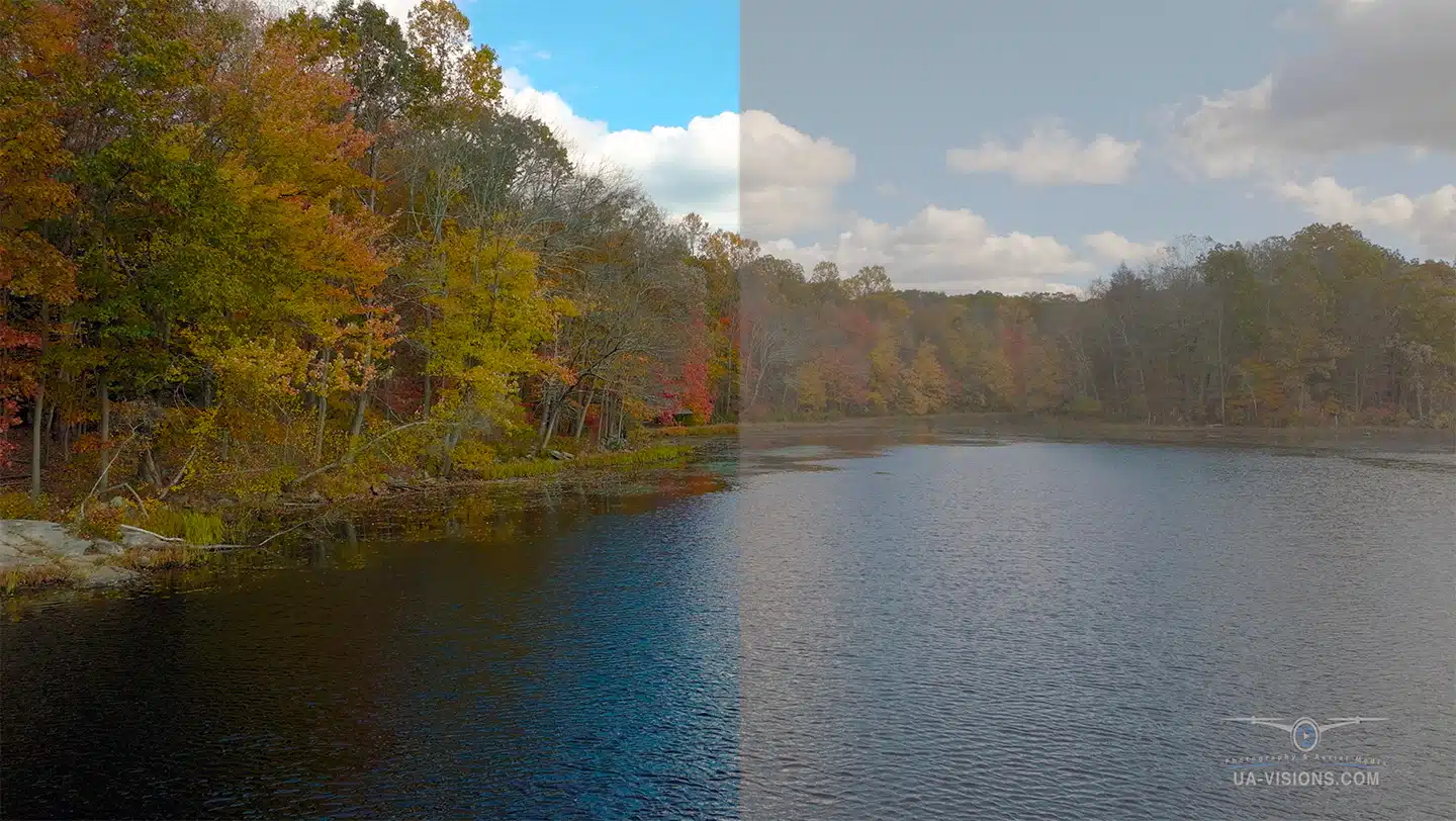
    Similar to RAW photos, DJI give you the option to shoot video in D-Log or D-Cinelike. Both D-Log and D-Cinelike will produce similar-looking raw video. Neither will appear to have enough contrast or saturation, and they will appear flat and boring. This is so that video editing software may enhance the color, contrast, and vitality of the clip, which is what both modes are designed to do.


    D-Log vs D-Cinelike

    D-Cinelike (Left) vs. D-Log (Right)

    D-Cinelike and D-log vary primarily in that D-Cinelike captures a wider spectrum of colors than D-Log. When using D-Log, the color gamut that is collected is much more condensed. D-log, on the other hand, enhances the highlights while keeping the shadows from becoming overly dark.

    These two modes have one thing in common: for the greatest results, both must be color graded using your choice of editing software. Both shooting modes are designed to record a lot of information that can subsequently be enhanced using video editing software rather than producing the finished result directly from the micro SD card.

    Tip# 15 – Using the Sun

    You may have heard to always shoot with the sun to your back. This is not always the case and you can create a starburst effect if you setup the camera correctly. To do this, you need to have a drone that has an aperture built-in. When you close down the aperture to f/11 you can create a starburst looking effect that looks like a star. Again, you need a drone that gives you the ability to change the aperture settings. Otherwise, it creates a bright ‘overexposed’ orbit out in the sky. It’s going to be super bright in comparison to everything else that you’re filming.

    Tip# 16 – Freeze Frames

    Most major video editing software packages have a functionality that will allow you to freeze a frame from your video footage. This should really be used as a backup. If you want to freeze the action of a frame, increase your shutter speed to create crisp clear images. When you’re shooting a photo with your drone at a low shutter speed, you’re going to see some motion blur in your shot unless it’s something specific that you want to see the blur.

    Tip# 17 – Use ND Filters

    ND Filters is equivalent to putting sunglasses on your camera and it’s gonna help you bring down your shutter speed to be able to create lots of motion blur in your shot. If you use something like an ND 1000 on footage of the ocean, you could get these really stylistic shots but this is a specific style of photography so you don’t always want to fly with one of these filters on.

    AEB Example

    Five Photo AEB Shot with a DJI Mavic 3

    Merged AEB Example

    Merged in Photoshop

    Tip# 18 – Bracketing

    The bracket feature will allow you to take multiple photographs in quick succession. The camera will take a normal photo and it’s gonna take one brighter and then one darker. If you have a setup to take five shots, it will take two brighter and two darker. One benefit of using bracketing is that if you didn’t nail your exposure the first time, you could use one of the other shots and most likely going to have the proper exposure. Additionally, if you want to create a composite and merge two or more exposures together to create a High Dynamic Range (HDR) photo inside your editing software, bracketing is the way to go.

    The above five photos are an example of a five shot bracket. As you can see, each image has a different exposure. The two on the left are much lighter than the two on the right. You can either choose the photo that has the best exposure or import some or all into your preferred editing software and merge them together to create and HDR image.  Here we used Adobe Photoshop to merge the five images.

    Tip# 19 – Aspect Ratios

    Don’t shoot in the 16×9 ratio. You’ll want to make sure that you’re shooting in the 4×3 ratio if you’re drone allows it. This lets you use the full height and width of your camera’s sensor to get the most information into your photo. If you later decide in post processing you want a 16×9 look to your image, you can always crop it down, but you can’t go the other way if you want to go up to 4×3.

    Tip# 20 – Composition and the Rule of Thirds

    I’m sure you’ve heard of the rule of thirds if you’ve been doing photography for any length of time. The rule of thirds is great at getting your subject aligned in your composition, but don’t always rely on it. The rule of thirds is breaking your image up into quadrants and then putting your subject on one of these lines. The rule of thirds works great especially for putting your horizon on a third or putting a person, but don’t always rely on the rule of thirds. You may find that sometimes you want to just center your subject. This is ‘sometimes’ a very compelling shot when you have a really bold image of a subject centered in the middle of the frame.

     Tip# 21 – Simply Put, Practice, Practice, Practice!

    Just get out there and try a little of everything. This will help find your style of shooting and get you comfortable with the many techniques used to create great drone footage.

    We hope that some if not all of these tips will help you in some way in the future. Feel free to leave a comment or any tips that have helped you.

    Thanks for reading and showing your support.

    Portrait Photography

    Portrait Photography

    Capturing the essence of your personality or event with our professional portrait photography services. Tailored to your unique needs, we offer individual, family, corporate, and lifestyle portraits that truly reflect your individuality and style.

    Event Photography and Videography

    Event Photography and Videography

    Preserve the magic of your special day with our event photography and videography services. From weddings to corporate events, we offer aerial videos & photos that add a unique perspective to your event memories.

    Marketing and Advertising Content

    Marketing and Advertising Content

    Harness the power of video to convey your brand’s message compellingly. Our custom drone videos are crafted to resonate with your audience, driving engagement and fostering conversions through quality video content.

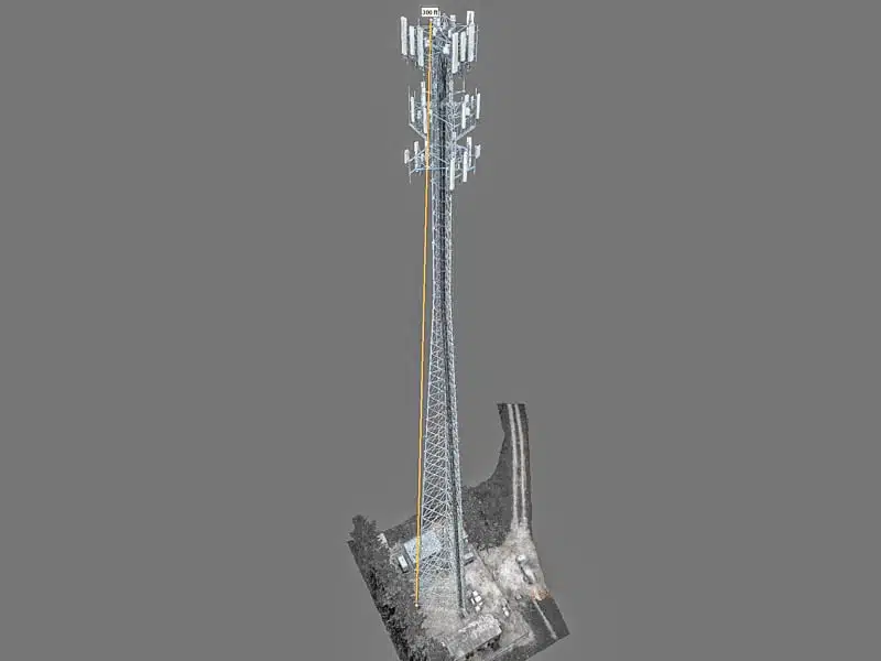
    Drone Mapping and 3D Modeling

    Drone Mapping and 3D Modeling

    Leverage our advanced drone mapping and 3D modeling services for detailed and accurate visual data. Ideal for construction, real estate, and more, we provide the insights you need to make informed decisions.

    Experience Our Work WITH VIDEO Visit our Social Pages

    Digital Media Services & Drone Imaging | Special Event Digital Media

    All our captivating video footage from many of our projects can be found on our social media pages. Dive into a world of mesmerizing digital media services & drone imaging and relive the moments we’ve captured by clicking one of our pages below.

    Residential and Commercial Real Estate Services

    Residential and Commercial Real Estate Services

    Showcase your properties in their best light with our aerial photography for real estate. Offering both aerial and ground-level photography, 3D virtual tours, and immersive video tours, we create visuals that attract potential buyers and accelerate sales.

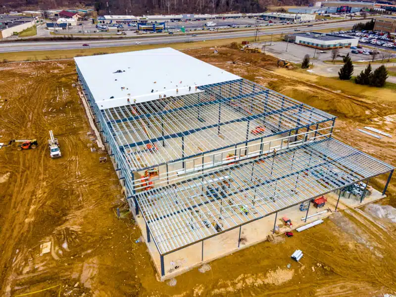
    Construction Progression and Monitoring

    Construction Progression and Monitoring

    Keep track of your construction projects with our services, offering regular aerial drone inspections to monitor progress, ensure safety compliance, and address issues promptly.

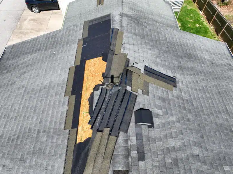
    Aerial Drone Inspection Services

    Aerial Drone Inspection Services

    Our drone inspection services offer a safe and efficient way to inspect hard-to-reach areas. From infrastructure inspections to roof check-ups, we provide the visual data you need to make informed decisions.

    Drone Flying: 15 Tips on Safe Drone Operation

    Drone Flying: 15 Tips on Safe Drone Operation

    Witten by Ryan Higginbotham

    n

    UA-Visions Co-Owner

    Photo of a father and son flying a drone

    In this article, I’m going to go through fifteen different Tips on Safe Drone Operation to help you to become a better drone pilot. Whether you’re a beginner or you’ve flown drones for years, there’s a lot of information in this that we are going to cover that will to help you on all of your future flights. Some of the topics we’ll be touching on will be general functionality and operation. I plan on putting together another article that will cover tips to produce good looking video footage and photos. Our drone manufacturer of choice is the DJI lineup so most of the content will be applicable to them although many of these tips and tricks can be applied to any drone manufacturer.

    nn

    Let’s dive in.

    n

    Tip #1 – Learn You’re Drone Inside and Out

    n

    Learn how your drone operates, how the propellers go on, how the gimbal works, and all the physical aspects about the drone itself as well as the controller. Just as important, the app you’ll be using to control your drone is an area that you will want to become familiar with. You’ll need a good understanding of the app and what all the buttons do because when you go out to fly. Make sure that when you’re in the air and you’re trying to get some unique photos or a cinematic video, you know what everything means and what the satellites mean. Knowing what each icon on the screen represents is fundamental. Icons such as signal strength and the different on-screen pop-ups such obstacle avoidance warnings. Learning the different components is not hard or complicated but there is a decent amount to learn to be able to know what your drone is doing up in the sky.

    n

    Tip #2 – Have a Stationary Launch and Landing Location

    Drone landing and launch pad

    Do your best to ensure the area is clear of dust and debris so that when you take-off or land you don’t get dirt in your motors or gimbal. A budget friendly and useful item you could purchase is a is a launchpad. They just fold up and they go in your in your bag or backpack. This way you have a launchpad anywhere you go.

    nn

    Tip #3 – Practice, Practice, Practice

    n

    Find somewhere to test out your drone such as a park or a large empty parking area. Use this time to learn the controls. This will establish a solid understand on the controller and how the drone moves in the air in a safe controlled environment.

    n

    Tip #4 – Establish a good GPS Connection

    n

    Person using a drone controller

    When you have a strong GPS signal before you takeoff, your drone is going to know where it is on the earth.It uses Global Positioning System (GPS) coordinates from satellites orbiting the earth to know exactly where it is. Ensuring you have a strong connection between before you just go fly will set your home position.The home point is set on a DJI drone when enough GPS satellites connect. It’s important to know exactly where the home point is because if there’s an issue it’s going to automatically return to that location. An issue that may arise could be happen if the drone disconnects from the controller.The drone will then automatically return to home, but only if the home point is set.

    n

    Tip #5 – Inclement Weather

    n

    Drones are not generally waterproof. Although they will work in certain conditions, why would you risk damaging an expensive piece of equipment or worse. Before your next flight, check the forecast for what the weather holds. Additionally, precipitation should not be your only concern. Wind is also a factor that should be recognized. A good rule of thumb for flying on windy days is to always start by flying into the wind. The reasoning behind this has to do with battery life. If you begin by flying with the wind rather than against it, the drone will have to work that much harder to return since it must now fly against the wind to return. This opens the risk of not having enough battery life left to return to the home position.

    n

    Tip #6 – The 20% rule

    Drone Batteries

    Always leave yourself enough battery life to return the home point and don’t fly to the end of your battery. Through experience, I have found that beginning your return flight once your battery reaches 20% remaining life. In cases where you have flown a significant distance away from your start point, you may want to increase that percentage to 25 or 30%. Additionally, there are outside factors that can have a negative effect on battery life such as extreme environmental temperatures. Always give yourself a little cushion so you can bring it back safely. It’s better to have a few spare batteries than trying to push your battery as far as I could possibly go.

    n

    Tip #7 – Landing on a Solid Flat Surface

    Do your best not to catch/land your drone with/in your hand unless it’s necessary. If you’re still new, I suggest finding a solid stationary location you’re able to take-off and land your drone safely without needing to use your hands. I can’t say I haven’t done it, but trust me, I’ve learned my lesson. Last year I was at the beach and didn’t want to get my landing pad out of my backpack, so I tried catching it with my hands. Bad idea. As I was reaching my hand up toward the drone, a strong gust of wind shifted the drone just enough for the propeller blades to clip several of my fingers. Thankfully this isn’t a loss of a limb type injury, but it didn’t feel good. It gave me a few scratches, but worst of all, the drone immediately fell to the ground. Remember, I was at the beach, so this wasn’t some grassy field, it was sand. It took me a couple hours to get all the fine particles of sand out of all the crevices. All in all, I got off easy. It could have been much worse.

    n

    Tip #8 – Screen Cover

    n

    Screen shade for drone controller

    It happens all the time, you go outside to fly on a nice sunny day and the sun glare makes it hard to see you screen. When you’re flying your drone and can’t see your screen, there is an increased risk of crashing or injury. Find a nice shady spot out of direct sunlight. This will keep your phone (if your screen isn’t built-in) from getting too hot and dimming and your able to keep good situational awareness. Another option is to pick up a screen shade. Like the launchpad/landing pad, sun hoods and screen covers are fairly cheap.

    n

    Tip #9 – Pre-Equipment and Gear Check

    Photography Equipment and Gear

    Check each battery, your memory cards,

    n

    controller battery and anything else you need before you leave. There’s been times where I’ve driven two hours away to a project and forgotten to put the SD card back into the drone from the last flight. Try not to rush yourself because it will almost always lead to issues. Take a few minutes to go over all of your gear before the trip ensuring you’re good to go.

    n

    Tip #10 – Return Altitude

    Don’t forget to set your ‘return to home’ altitude. I know of a local Fire Department in West Virginia that had a $20,000 drone and one day when they were using it the controller lost connection with the drone. West Virginia is full of mountains and if they would have set the return to home altitude, that wouldn’t have been an issue. Instead, it was still set extremely low from the factory and as the drone was returning, it flew right into the side of a mountain. As a good rule of thumb, set your return to home altitude to the same height as your max altitude for that flight. Generally, this won’t exceed 400 feet Above Ground Level (AGL).

    n

    Tip #11 – Quick Flight Test

    n

    When you take-off, hover just a few feet off the ground and double check everything is working correctly. It only takes a few seconds. This gives the drone a chance to establish a strong GPS signal and give you a chance to check the propellers and gimbal is fully operational.

    DJI Mavic Pro Hovering

    Tip #12 – Rules and Regulations

    n

    Know the rules and regulations for the area before you start flying. Each location is different, and you should always make sure that you’re flying within the rules that are set in place. There are regulations in place within the USA that we must abide by, but if you’re in another country it might be a different set of rules. Wherever you’re flying, know exactly if you’re authorized to be flying there and what the rules are.

    nn

    Some of the rules and regulations established in the US include:

    n

    – You must fly within visual line of sight

    n

    – Altitude must be below 400 feet

    n

    – Each drone must be registered with the FAA

    n

    – You can only fly for recreational purposes unless you have your part 107 license

    n

    – Ensure you’re not interfering with any manned aircraft

    n

    – You can only fly in class G airspace unless authorized to fly in controlled airspace

    n

    Tip #13 – Want to Make Money?

    n

    Get your part 107 license. This allows you to use your drone for commercial purposes (i.e. make money). This could be through selling your photos on your personal website or one of the many stock footage websites. You can’t legally sell your drone footage unless you have your part 107 license. Obtaining your license isn’t tough and you’ll learn many of the fundamentals of flying along the way. If your wanting your part 107, gather the study material and dig in. The test isn’t hard, but you will need to study before the test in order to pass.

    n

    Tip #14 – Active Track

    n

    This goes along with a couple earlier tips about knowing your drone, the controller, and the app. Active track is part of the app and one of those things to know and practice before you attempt to using it for a project. Find an open area and just play around with active track and learn everything about how you’re active track works depending on which drone you have. The tracking will be different as well as different limitations on these drones. Some drones only have sensors on the front, back, top and bottom while some have sensors all the way around. If you were to be using a drone that doesn’t have sensors all the way around, there is a chance it could be tracking you and fly right into a tree. Learn each function of your drone in a safe open area.

    n

    Tip #15 – Drone Limitations

    DJI Drone

    Understand how your obstacle avoidance works. As I mentioned above, some drones such as the Mavic Air 2 doesn’t have obstacle avoidance sensors all the way around and could fly into something. Unlike the Mavic 3 that has omni-directional sensors providing 360º of obstacle avoidance. While these sensors are extremely handy, when you switch to ‘Sport Mode’ these sensors are no longer active. This means you could end up flying straight into a brick wall if you’re not careful.

    n

    Hopefully these Tips on Safe Drone Operation Until the next Flight…

    We hope that some if not all of these tips will help you in some way in the future. Thanks for reading and showing your support.

    nn

    For more information on our services, stop in and check us out at www.ua-visions.com.

    nnn

    -Ryan